File:Brasil-Politico-Mapa-IBGE.pdf
Jump to navigation
Jump to search

Size of this JPG preview of this PDF file: 800 × 565 pixels. Other resolutions: 320 × 226 pixels | 640 × 452 pixels | 1,024 × 723 pixels | 1,280 × 904 pixels | 1,754 × 1,239 pixels.
Original file (1,754 × 1,239 pixels, file size: 5.81 MB, MIME type: application/pdf)
Captions
Captions
Add a one-line explanation of what this file represents

|
File:Brasil-Politico-Mapa-IBGE.svg is a vector version of this file. It should be used in place of this PDF file when not inferior.
File:Brasil-Politico-Mapa-IBGE.pdf → File:Brasil-Politico-Mapa-IBGE.svg
For more information, see Help:SVG. |
 |
Summary[edit]
| Description |
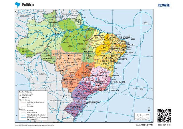
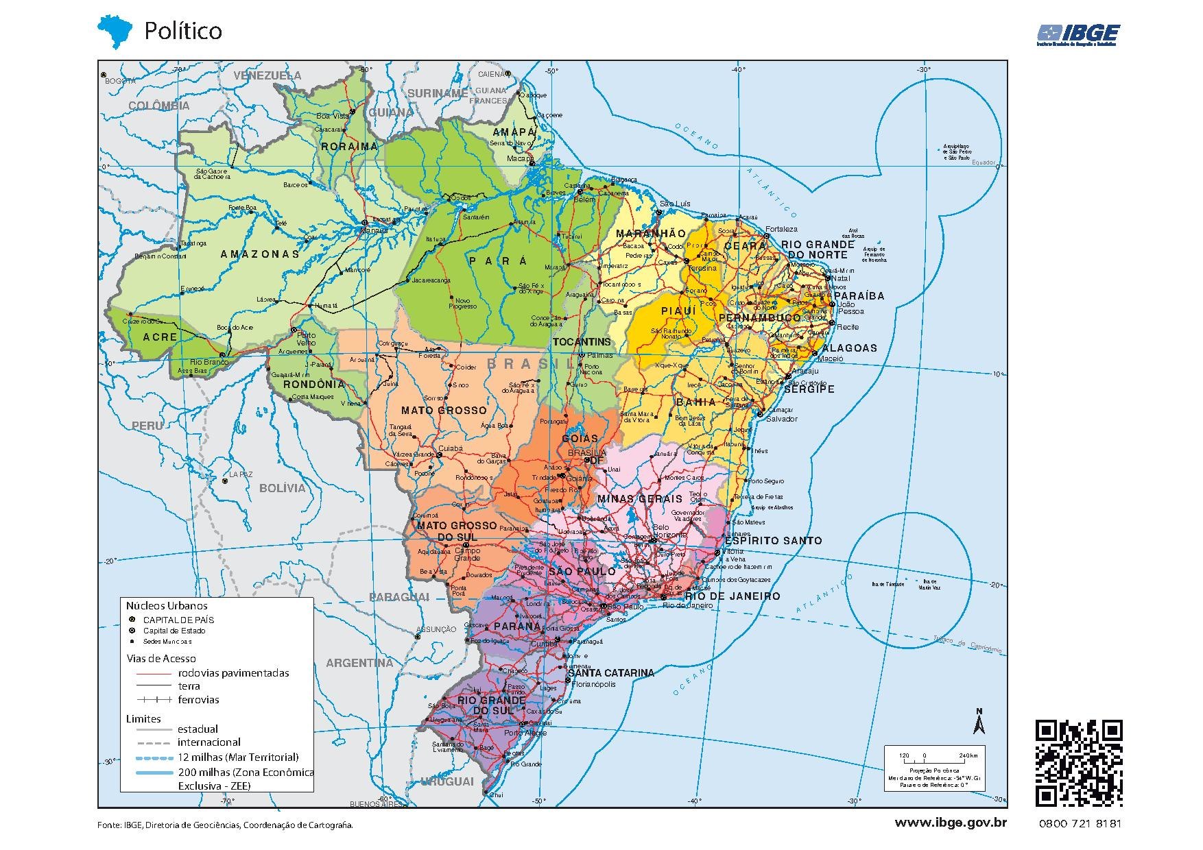
Português: Mapa Brasil Político com os Estados e Cidades do Brasil - Mapa Escolar - Fonteː IBGE (Governo do Brasil) English: Description (English): Political Map Brazil with the States and Cities of Brazil - School Map - Source: IBGE (Government of Brazil) (October/2018) |
| Date | |
| Source | The Government of Brazil authorizes the free download of maps of Brazil = https://atlasescolar.ibge.gov.br/images/atlas/mapas_brasil/brasil_politico.pdf |
| Author | IBGE - Instituto Brasileiro de Geografia e Estatística (Governo do Brazil) |
| Permission (Reusing this file) |
https://atlasescolar.ibge.gov.br/images/atlas/mapas_brasil/brasil_politico.pdf |
Licensing[edit]
This file is licensed under the Creative Commons Attribution-Share Alike 3.0 Unported license.
- You are free:
- to share – to copy, distribute and transmit the work
- to remix – to adapt the work
- Under the following conditions:
- attribution – You must give appropriate credit, provide a link to the license, and indicate if changes were made. You may do so in any reasonable manner, but not in any way that suggests the licensor endorses you or your use.
- share alike – If you remix, transform, or build upon the material, you must distribute your contributions under the same or compatible license as the original.
File history
Click on a date/time to view the file as it appeared at that time.
| Date/Time | Thumbnail | Dimensions | User | Comment | |
|---|---|---|---|---|---|
| current | 21:27, 5 October 2018 |  | 1,754 × 1,239 (5.81 MB) | Amgauna (talk | contribs) | User created page with UploadWizard |
You cannot overwrite this file.
File usage on Commons
The following page uses this file: