January 11, 2020 – Montville, NJ
Difficulty: Moderate
Length: Approximately 5 miles
Max elevation: 934 ft.– total elevation gain approximately 700 ft.
Route type: Circuit
Map: Jersey Highlands Trails Map #125 (Central North Region) – Morris County Park Commission Trail Map
Please Note: Park-wide re-blazing of Pyramid Mountain Natural Historic Area trails is complete as of March 17, 2021. Trail colors have changed and it is strongly suggested that hikers photograph or print both trail maps below for easy reference during your outing.
Park Overview:
Pyramid Mountain Natural Historic Area encompasses Pyramid and Turkey mountains in Kinnelon, Boonton and Montville. Its features include unusual glacial erratics, dramatic rock outcrops, extensive wetlands and waterfalls.
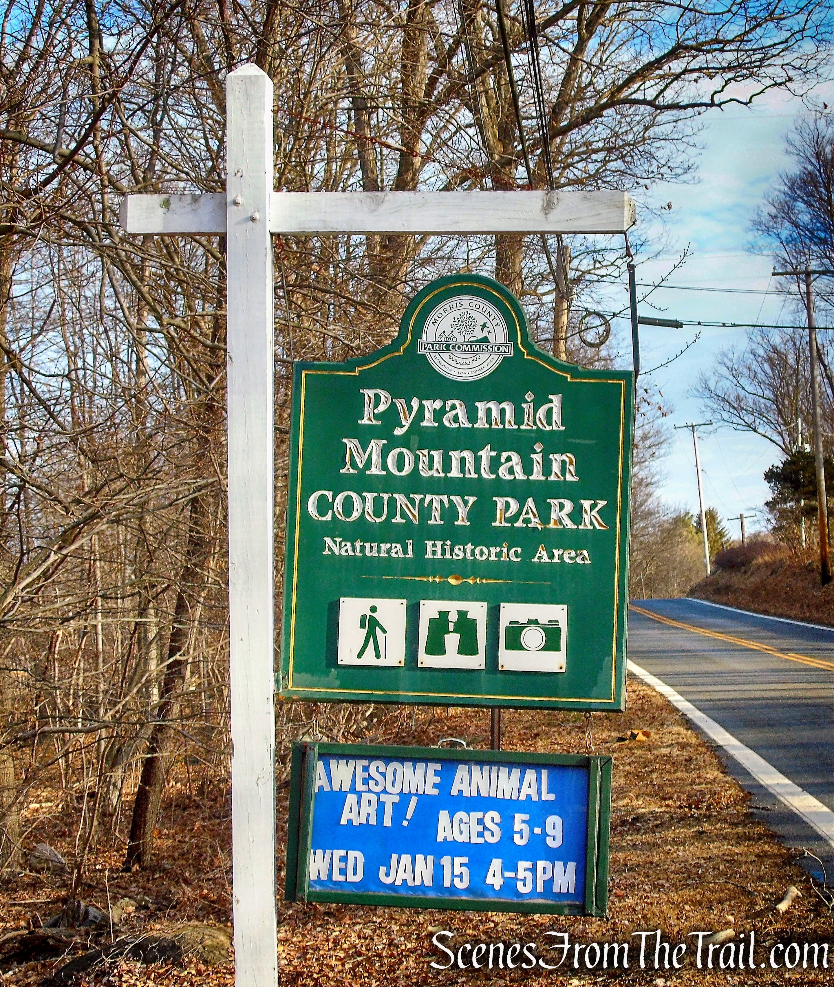
Pyramid Mountain Natural Historic Area
The two most remarkable erratics in the area are Bear Rock, one of the largest in the state, and Tripod Rock, a 160-ton boulder perched atop three smaller boulders.

Tripod Rock – Pyramid Mountain Natural Historic Area
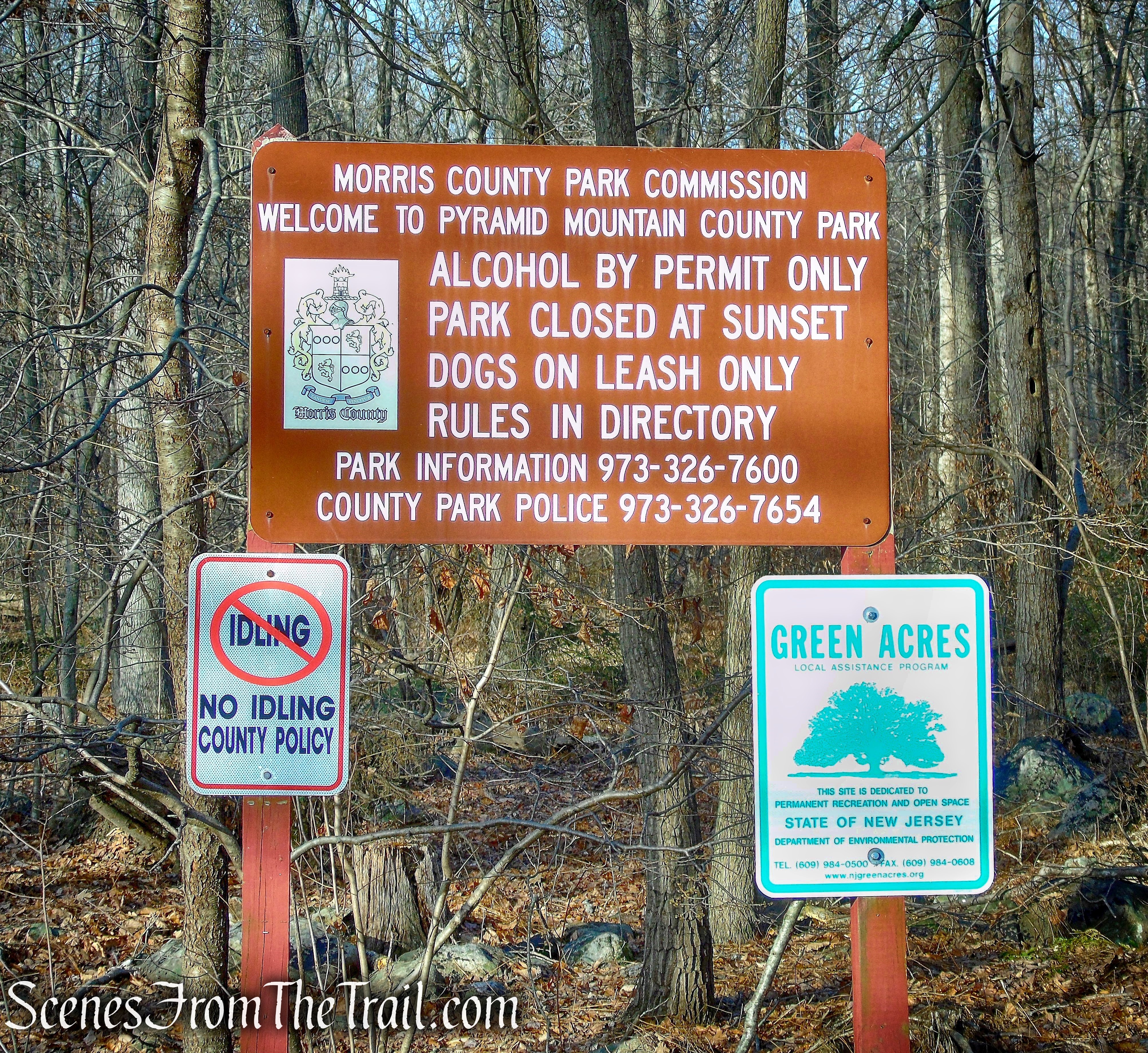
- This area of 1,675 acres offers rugged trails, fields, forests, rock outcroppings, and wetlands. The highest point in the park is 934 feet with a view of the Manhattan skyline. Pyramid Mountain trails are open daily Sunrise to Sunset throughout the year.
- The Visitors Center is open 7 days a week, 9 a.m. – 4:30 p.m. throughout the year.
- The forested property is managed by the Morris County Park Commission.
- The trails are maintained by the New York-New Jersey Trail Conference.
Pyramid Mountain Natural Historic Area
History:
- For over ten thousand years, this natural area provided shelter and served as a hunting, fishing, and gathering site for the Lenape Indians. Over three hundred years ago, the Lenape Indians experienced their first encounter with European colonizers.
- Many of the first explorers and traders who discovered this corner of old Pequannock were of Dutch extraction. Surveyor stones and enduring stone walls still mark their homestead farms and woodlot boundaries.
- Pyramid Mountain was established in 1989, after a lengthy grassroots efforts to preserve the area from development. The first parcel was funded through support from the Mennen Company in 1989 and the Visitors Center was dedicated in 1993.
Trails Overview:
The nearly 30 miles of marked trails provide opportunities to experience expansive views from flat-topped ridges, visit glacial erratics, see waterfalls and observe wetlands. The Visitors Center is a starting point for loop hikes. There are more than a dozen trails in Pyramid Mountain and (just across Boonton Ave, County 511) in Turkey Mountain, ranging from 0.7 to 7.3 miles. Several new trails were added to the park in 2008/09, including a 1.2-mile white-blazed trail, plus a black-dot trail and yellow-blazed trail, with a combined length of 2.8 miles. The longer of these two runs from Powerville Road in Boonton Township to Bear Rock at Pyramid Mountain.
Hike Overview:
This loop hike covers most of the points of interest in the Pyramid Mountain section of the park. This is a good hike to do if its your first time visiting. Please be advised that this is a popular hiking destination and in nice weather, does get crowded. A good hike to do on a weekday, in cold weather or early mornings.
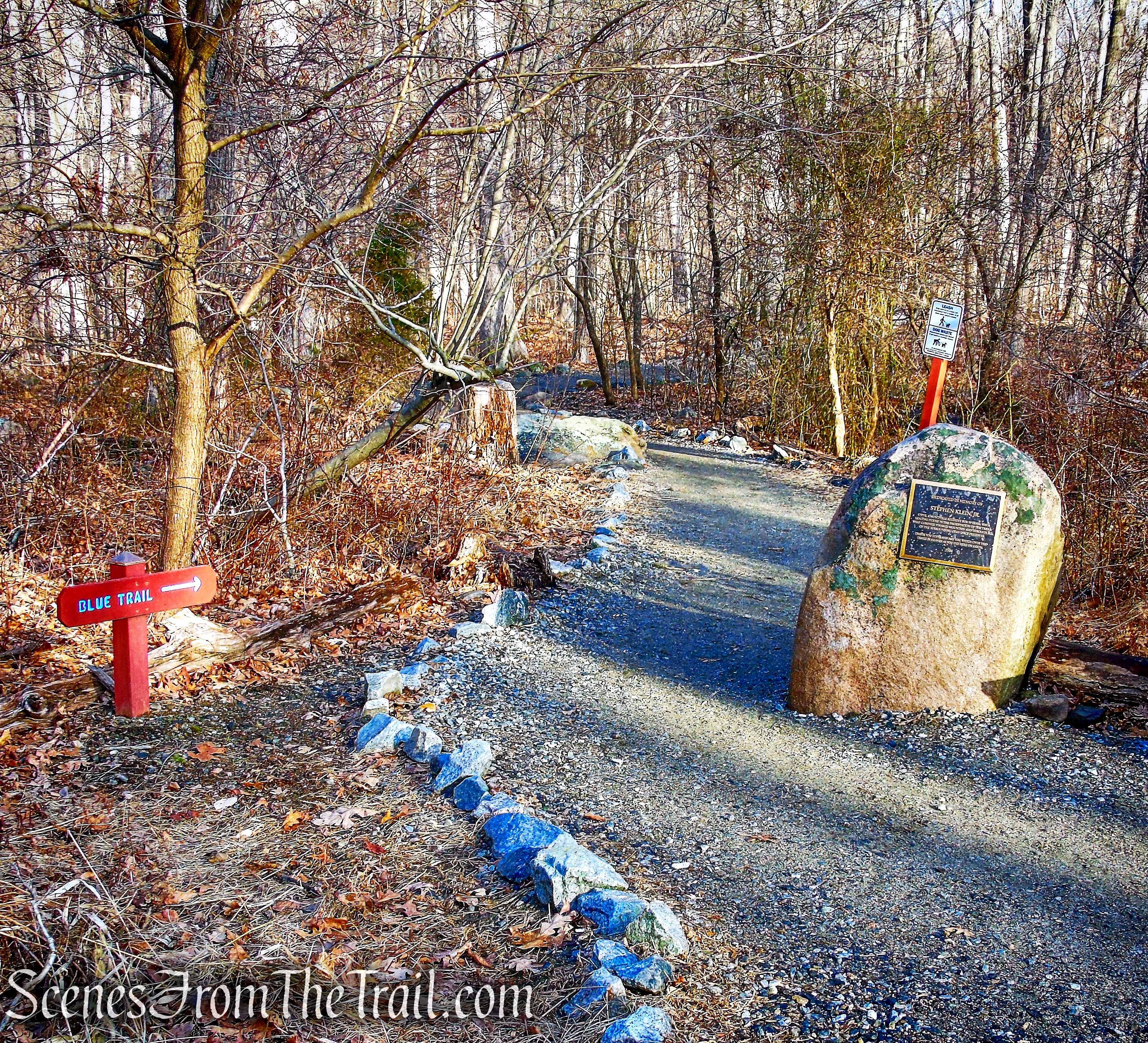
This hike begins at the Visitor Center parking area and is done counter clockwise. This hike covers numerous trails and should not be attempted without having a trail map on your person.

Pyramid Mountain Natural Historic Area
The Hike:
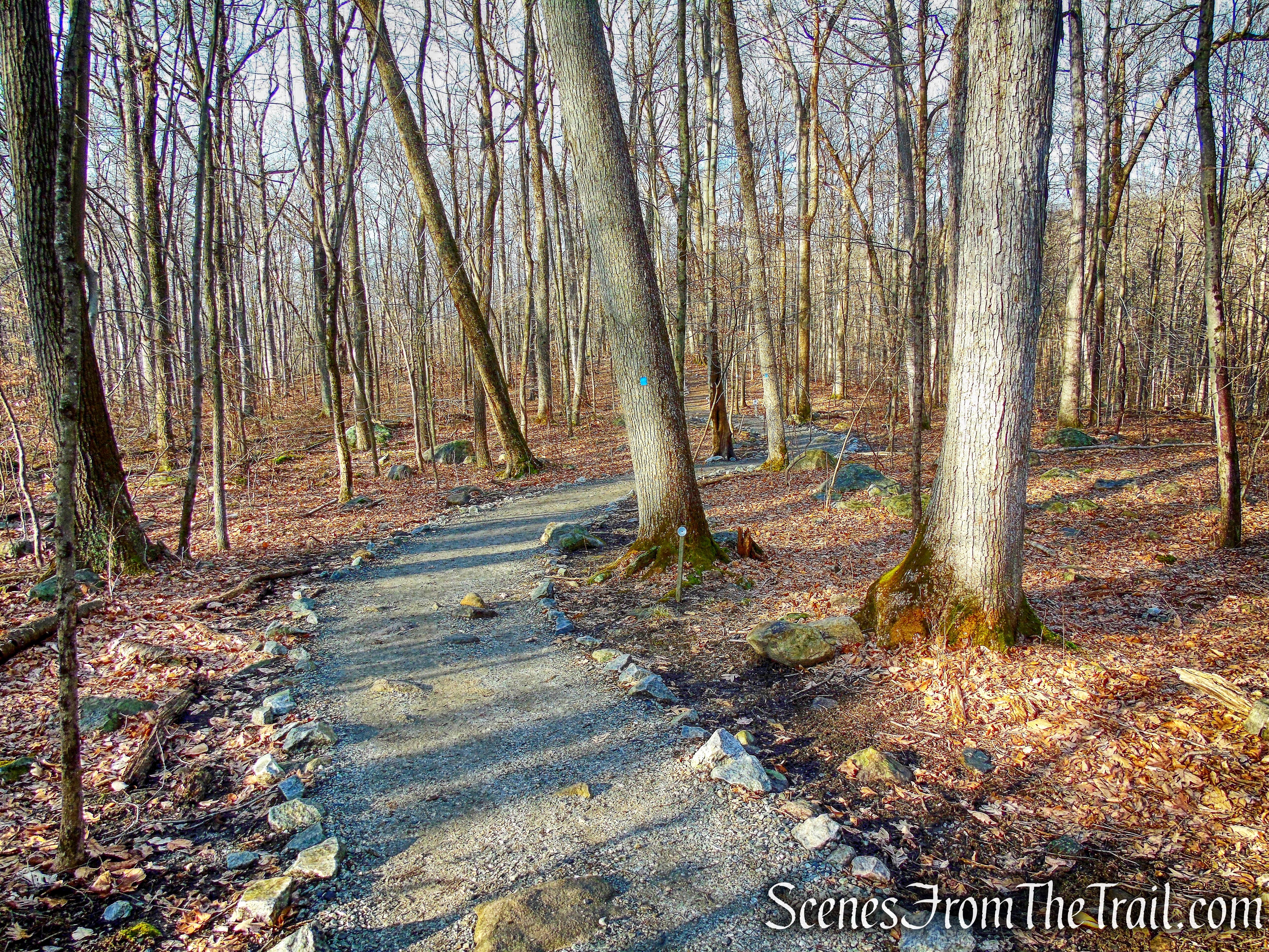
From the southern end of the parking area, follow the Blue Trail, which starts just north of a kiosk and immediately passes a memorial plaque for Stephen Klein, Jr. After crossing a woods road, the Blue Trail crosses Stony Brook on a wooden footbridge. In another 125 feet, the Yellow Trail begins on the right. Turn right and follow the Yellow Trail, which crosses under power lines and heads north on a nearly level footpath, with huge boulders above on the left and a camp recreation area (with a grassy ballfield, a picnic area and a small pond) below on the right.

Blue Trail – Pyramid Mountain Natural Historic Area
Blue Trail – Pyramid Mountain Natural Historic Area

Blue Trail – Pyramid Mountain Natural Historic Area
Blue Trail – Pyramid Mountain Natural Historic Area

Blue Trail – Pyramid Mountain Natural Historic Area

Yellow Trail – Pyramid Mountain Natural Historic Area

Yellow Trail – Pyramid Mountain Natural Historic Area

Yellow Trail – Pyramid Mountain Natural Historic Area
In a quarter mile, the Orange Trail leaves to the right. Continue along the Yellow Trail, which soon bears left and begins to climb rather steeply. At the top of the climb, there is a limited viewpoint over Turkey Mountain to the east. The trail now heads back into the woods, bears right and descends slightly.
Yellow Trail – Pyramid Mountain Natural Historic Area
Yellow Trail – Pyramid Mountain Natural Historic Area

Yellow Trail – Pyramid Mountain Natural Historic Area

Yellow Trail – Pyramid Mountain Natural Historic Area

Yellow Trail – Pyramid Mountain Natural Historic Area

Yellow Trail – Pyramid Mountain Natural Historic Area

Yellow Trail – Pyramid Mountain Natural Historic Area

Yellow Trail – Pyramid Mountain Natural Historic Area

Yellow Trail – Pyramid Mountain Natural Historic Area

Yellow Trail – Pyramid Mountain Natural Historic Area
Almost a mile from the start, you’ll again reach the Blue Trail. Turn right here and follow the joint Blue and Yellow Trails through thick stands of mountain laurel. After a short distance, the Yellow Trail leaves to the left. Keep to the right here, and continue along the Blue Trail.

turn right on joint Blue/Yellow Trails

joint Blue/Yellow Trails
turn right on Blue Trail

Blue Trail – Pyramid Mountain Natural Historic Area
In 250 feet, a blue-and-white side trail goes off to the left. Follow this trail, which leads in a short distance to Lucy’s Overlook, a west-facing viewpoint from open rocks, named for Lucy Meyer, the leader of the fight to save this mountain. Continue ahead on the blue-and-white trail to its terminus on the Blue Trail.
turn left on blue-and-white trail

Lucy’s Overlook Trail – Pyramid Mountain Natural Historic Area
Lucy’s Overlook Trail – Pyramid Mountain Natural Historic Area
Lucy’s Overlook Trail – Pyramid Mountain Natural Historic Area
Lucy’s Overlook Trail – Pyramid Mountain Natural Historic Area
Turn left onto the Blue Trail. In a short distance, you”ll arrive at a junction with the White Trail. Continue straight ahead (north) here, leaving the Blue Trail, and now following the White Trail.

turn left on Blue Trail

Blue Trail – Pyramid Mountain Natural Historic Area

Blue Trail – Pyramid Mountain Natural Historic Area
White Trail – Pyramid Mountain Natural Historic Area
White Trail – Pyramid Mountain Natural Historic Area
In about 500 feet, you’ll come to Tripod Rock – a huge boulder, perched on three smaller stones. Geologists explain that this boulder was deposited here by glacial action, although some believe that it may be a Native American calendar site. This unusual feature helped galvanize public support to preserve the mountain when it was threatened by development. This is a good place to take a break.

Tripod Rock – Pyramid Mountain Natural Historic Area
When you’re ready to continue, follow the white trail north for 0.4 mile to a junction (marked with a cairn) with the Red-on-White Trail.

White Trail – Pyramid Mountain Natural Historic Area

turn left on Red-on-White Trail
Turn left onto this trail, which goes through interesting, remote and rugged mountain scenery. In about a third of a mile, you will see a house directly ahead. Here the trail turns sharply left and climbs to the top of Eagle Cliff. After passing a huge balanced rock on the left, a glacial erratic known as Whale Head Rock, the trail bears left and begins a steep, rocky descent through mountain laurel thickets.

Red-on-White Trail – Pyramid Mountain Natural Historic Area

Red-on-White Trail – Pyramid Mountain Natural Historic Area

Red-on-White Trail – Pyramid Mountain Natural Historic Area

Red-on-White Trail – Pyramid Mountain Natural Historic Area

Whale Head Rock – Pyramid Mountain Natural Historic Area

Red-on-White Trail – Pyramid Mountain Natural Historic Area

Red-on-White Trail – Pyramid Mountain Natural Historic Area
At the base of the descent, the trail turns right and heads north for about 0.2 mile. It then bears left, crosses a branch of Bear House Brook and reaches a junction with the Blue Trail. Turn left onto the Blue Trail and cross Bear House Brook on a wooden footbridge. The Blue Trail continues south, paralleling Bear House Brook, which runs through the valley below on the left and eventually widens to form Bear Swamp.

Red-on-White Trail – Pyramid Mountain Natural Historic Area

terminus of Red-on-White Trail

turn left on Blue Trail

Blue Trail – Pyramid Mountain Natural Historic Area

Blue Trail – Pyramid Mountain Natural Historic Area
In another half mile, you’ll reach the huge Bear Rock. This massive glacial erratic, which can be said to resemble a giant bear, has been a local landmark for centuries. It was probably used as a shelter by Native Americans, and today it marks the boundary between Kinnelon Borough and Montville Township.

Bear Rock – Pyramid Mountain Natural Historic Area

Bear Rock – Pyramid Mountain Natural Historic Area

Bear Rock – Pyramid Mountain Natural Historic Area
From Bear Rock, turn left and follow the Yellow, Blue and White Trails across Bear House Brook on a wooden footbridge. A short distance beyond, at a fork, the Blue and White Trails bear left, but you should bear right, following the Yellow Trail, which begins a gradual climb. After a level section, the trail bears left and climbs more steeply to the ridge of Pyramid Mountain, where it reaches a junction with the Blue Trail.

Yellow Trail – Pyramid Mountain Natural Historic Area

turn right on Yellow Trail
Yellow Trail – Pyramid Mountain Natural Historic Area

Yellow Trail – Pyramid Mountain Natural Historic Area
Yellow Trail – Pyramid Mountain Natural Historic Area

Yellow Trail – Pyramid Mountain Natural Historic Area

Yellow Trail – Pyramid Mountain Natural Historic Area
Turn right, briefly retracing your steps along the joint Yellow and Blue Trails. A short distance ahead, the Yellow Trail leaves to the left, but you should continue ahead on the Blue Trail, which gradually climbs to the highest elevation on the Pyramid Mountain ridge (934 feet), marked by a cairn.

continue ahead on the Blue Trail

Blue Trail – Pyramid Mountain Natural Historic Area
Here, a double blue blaze indicates that the trail turns right, but first bear left and head to an east-facing overlook from open rocks, with the New York City skyline visible on the horizon on a clear day.

Blue Trail – Pyramid Mountain Natural Historic Area

Blue Trail – Pyramid Mountain Natural Historic Area

Viewpoint #1 – Blue Trail

Viewpoint #1 – Blue Trail

Viewpoint #2 – Blue Trail
After taking in the view, return to the Blue Trail and follow it as it gradually descends the southwest face of the mountain on switchbacks. On the way down, the Red Trail begins on the right. Then, near the base of the descent, the White Trail begins on the right at a large cairn. The Blue Trail turns left, climbs a little, then continues to descend gradually, soon crossing under the power lines. At the next intersection, where the Yellow Trail begins to the left, bear right, continuing along the Blue Trail, which crosses a footbridge over Stony Brook and proceeds ahead to the parking area where the hike began.
Blue Trail – Pyramid Mountain Natural Historic Area

Blue Trail – Pyramid Mountain Natural Historic Area

Blue Trail – Pyramid Mountain Natural Historic Area

Blue Trail – Pyramid Mountain Natural Historic Area
Review:
This is a great hike through a very scenic landscape, but the views are unimpressive. The powerlines mar the views throughout this hike. The trails are surprisingly rugged and slightly challenging. There are several sections of trails that are real ankle breakers which keep you focused. The area is littered with glacial erratics and interesting rock formations. The trails are well blazed as are the junctions (most have cairns). This hike covers numerous trails with many turns and it is advisable that you carry a paper map and a compass to avoid making a wrong turn. The Avenza Maps App is a good resource for a hike like this and this particular map is free. Towards the end of the hike (early afternoon), we began seeing a lot of foot traffic. Overall this is a really good hike that I would recommend.
Pros:
Glacial Erratics, rugged trails, scenic landscape, well blazed trails.
Cons:
Views are not that good, popular hiking destination that gets crowded in nice weather.
Take a hike!

Pyramid Mountain Loop – Pyramid Mountain Natural Historic Area
Sources:
- Trail Improvements in Pyramid Mountain
- New York-New Jersey Trail Conference
- Pyramid Mountain Natural Historic Area
