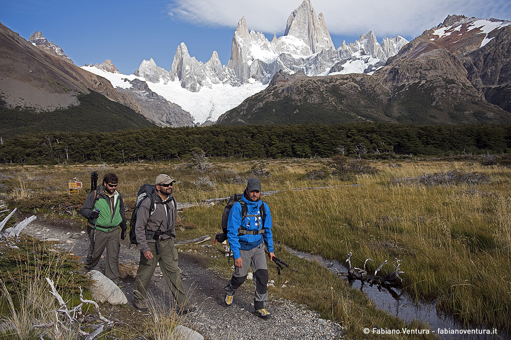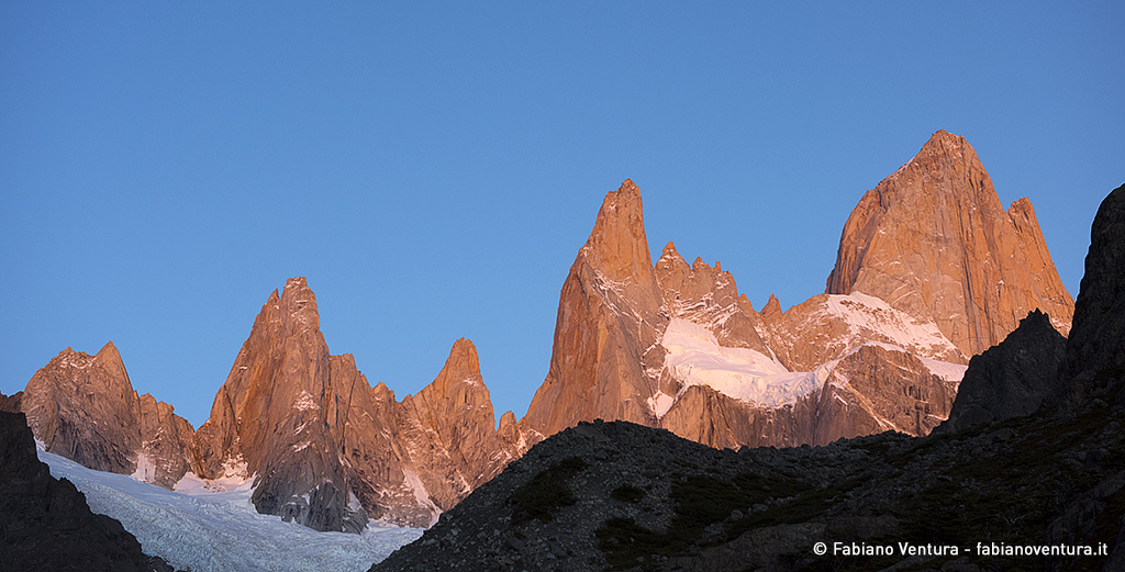
Fitz Roy and Cerro Torre two mythical mountains, in the collective imagination the most difficult in the world. Saturday, March 12th our adventure starts from El Chalten, a small town within the Los Glaciares National Park just a few hours walk from the great mountains.
Before leaving, I meet my friend Alejandro Caparros, director of the park who, interested in the didactic aims of my project, gives me the availability of a small shelter as a logistic base during the stay in the park and the help of the park rangers to reach the photographic locations with heavy equipment.
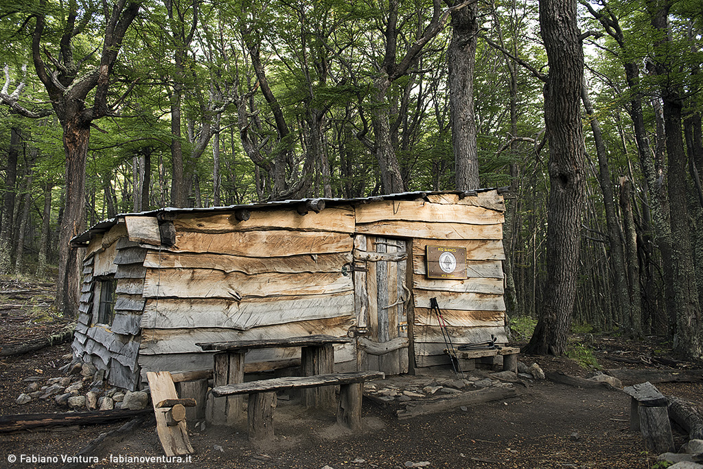
I reach the Blanco refuge near the Poincenot camp with the help of the park rangers Valeria Abruzzo and Valeria Crosta, who are passionate about their work describing the most beautiful areas of the park with many details, one of them practicing mountaineering and has already climbed the Fitz Roy three times!
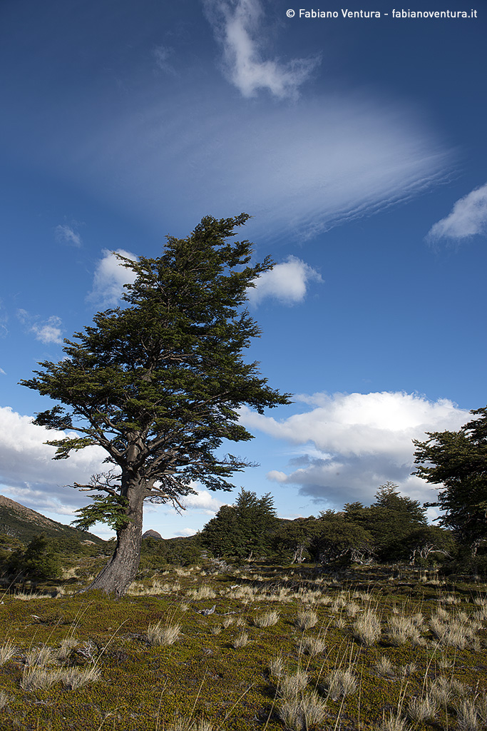
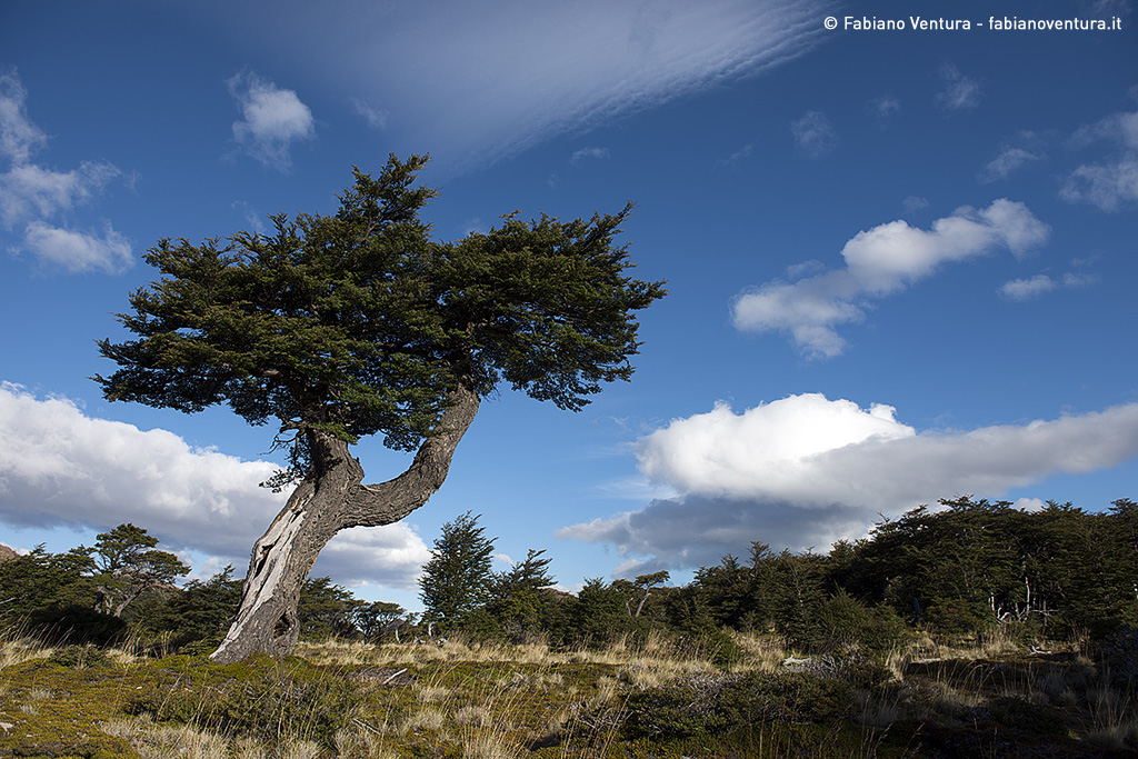
The shelter is beautiful all of wood and surrounded by wood, after offering a cup of tea to the girls, I greet them, they return to El Chalten and I prepare something to eat.
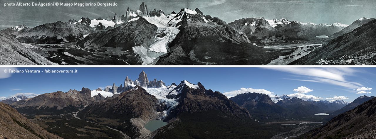
The next morning I reach two other rangers with which we leave for the first photographic lens, the summit of the Cerro Polo, a mountain from which I will try to repeat the overview of De Agostini depicting the entire skyline of Fitz Roy from a frontal position. We discuss the way to go, they are more likely for the longer but less tiring for the more direct but steeper, in the end I get convince and in three hours we climb the ridge east up to the antic.
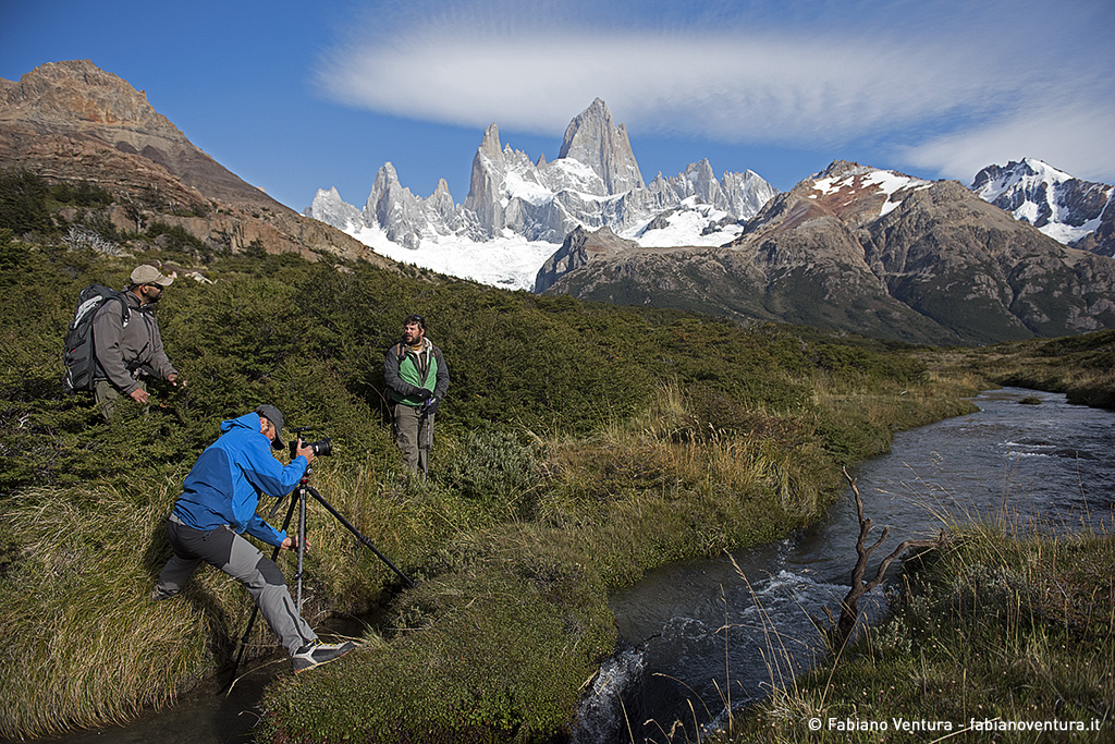
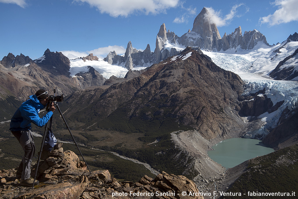
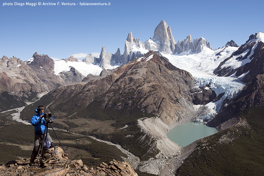
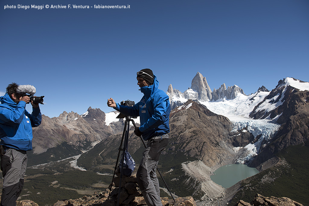
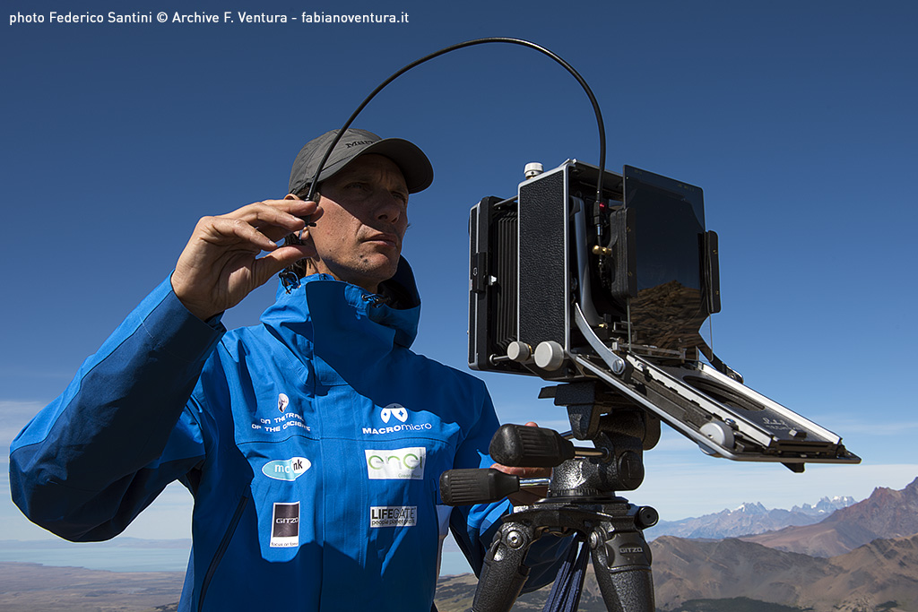
Once you reach the summit, as usual, I begin the search for the photographic point with the historical photos in hand, moving in various points to verify the exact overlap of the various mountain ridges. After long research, even in this case I find some rocks on the ground that I recognize on historical photography and confirm that I have found the same place of shooting! I run the Linhof folding and start shooting, the Fitz could be covered with clouds at any moment.
From the comparison between the historical image and the current view in front of me it is evident how the terminal part of the Blanco glacier has lost several hundred meters. In fact, from the historical photograph we can see the front of the glacier that occupies at least half the lagoon, while now a huge rock face has been discovered. The place is immense, from photography it is difficult to understand the dimensions of these valleys and mountains. To give just one example, the altitude of the valley floor is 600 meters while the summit of Fitz Roy is 3405 meters!
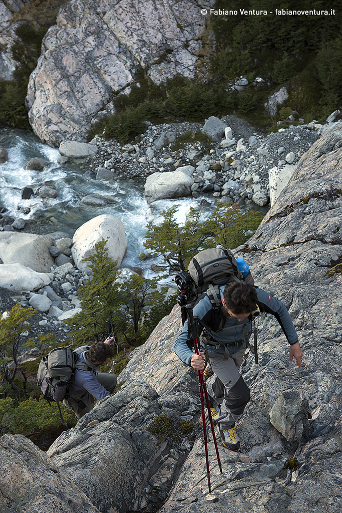
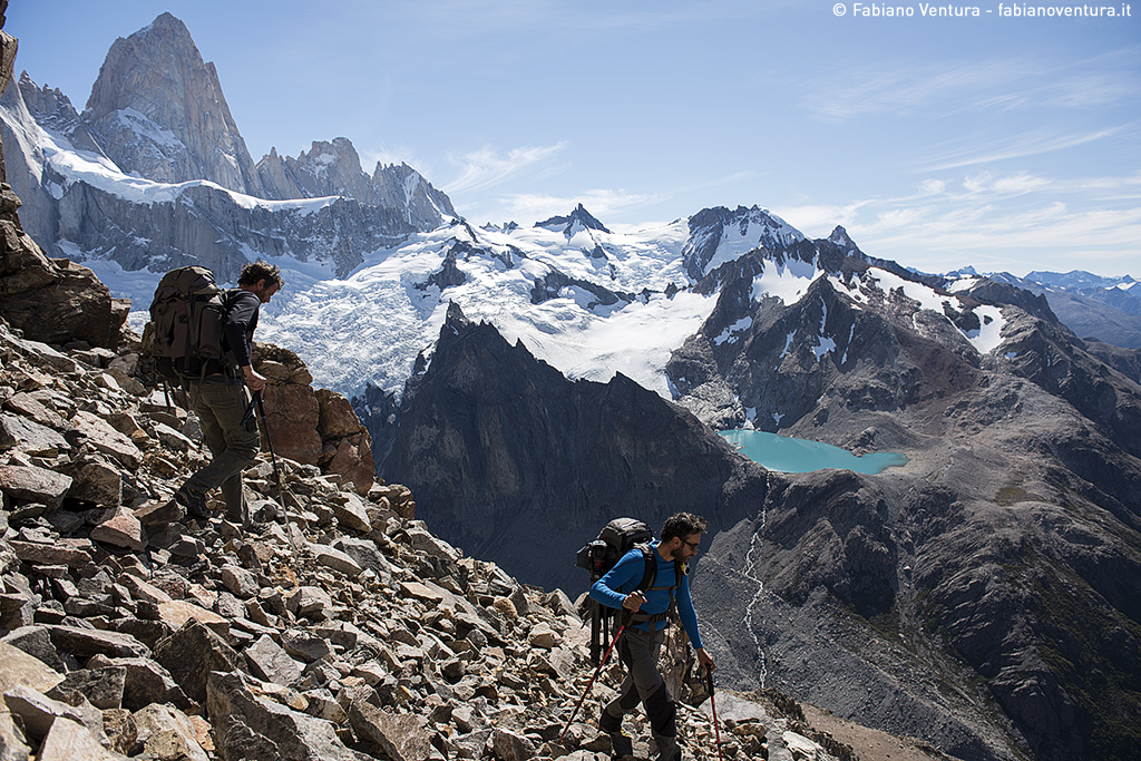
The expected time is good, so I decide to go down to the shelter and try the ascent of the Loma de las Pizzarras the following day. Looking at the mountain from the bottom I decide to climb along a steep channel carved into the woods by landslides that will allow me quick access to a ridge leading to the summit, contrary to the route suggested by the park ranger Julien Esperanza, who is with me today and indicates a ridge much longer. Going on an unknown route is often an unknown quantity, you never know what awaits you and if you manage to reach the summit, but the satisfaction of discovering only one way of access to the mountain is much higher than one already known.
The route, in fact, is the most direct but the first channel is impractical, too steep and dangerous. The ground under our feet yields continuously. To avoid this channel, we are forced to enter the forest and sometimes proceed by clinging to the branches of the trees. After about an hour we arrive at the top of the canal, cross it and head towards the steep ridge that will lead us to the summit on unstable boulders.
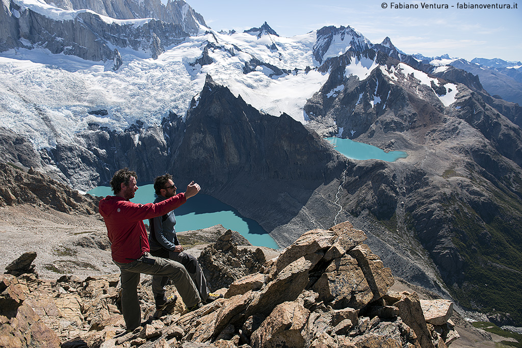
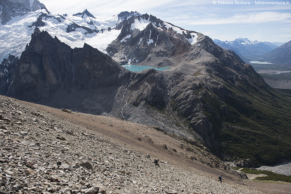
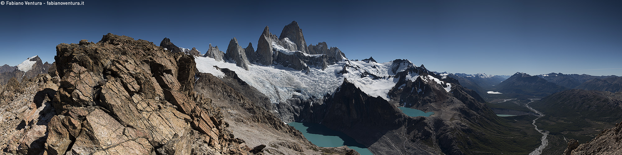
The view is breathtaking, on the one hand we can aim the impressive sequence of granite spiers of Fitz Roy with the glacial lakes of blue-green and on the other the Argentine desert with Lake Viedma.
After having repeated the historical photography of De Agostini I dedicate myself to take some pictures of that wonderful landscape, also creating a 360 ° panorama.
For the descent we decide a way still more direct and steep, we slip into the canine below the summit and slide down on the scree that we are committed not a little. The accumulated fatigue unfortunately makes me fall running but without major consequences, only some cuts and abrasion on the hands and legs.
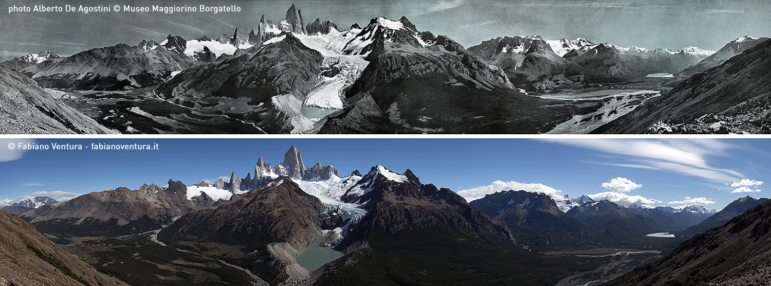
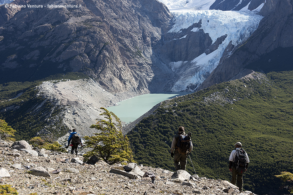
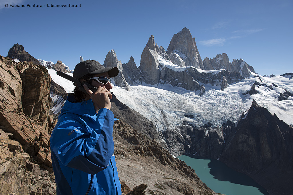
The next day we decide to cross the whole valley of the Madre lagoon passing through the beautiful wood of Lenga. We reach the Mirador Maestri after thirteen kilometers with a breathtaking view of the Cerro Torre where we repeat again a photograph of De Agostini. The Torre glacier is evidently set back from the front and has lost its thickness very much. In 2005 I remember that the glacier almost touched the rocks in the lagoon but today, in just ten years, it will have retreated at least 50 meters, let alone comparing it with the photograph of De Agostini taken in 1945!
Well…. in just 3 days I climbed almost 4000 meters in altitude and walked for over 60 km and repeated 5 historical photographs of De Agostini. It was hard but the effort was rewarded extensively!
Below is the fourth video clip of the expedition and a gallery with photographic comparisons and some backstage photos: